

Aktueller Wasserstand
Wasserstand LAT: 381 cm
Messzeit: 12:20 uur
Auf der Wasserkarte
Wählen Sie Ihre Gezeitenstation
App herunterladen
Mit der Die Gezeiten-App haben Sie jederzeit und überall die aktuellen Gezeitendaten zur Hand.
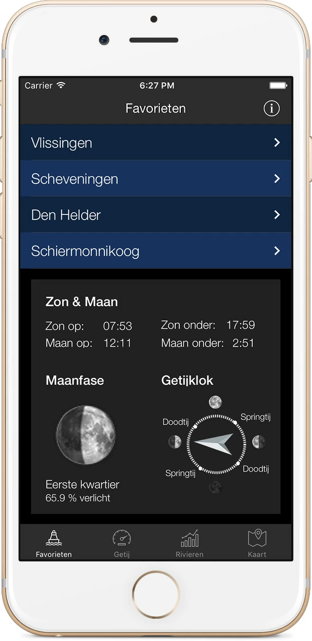
Laden Sie die App für iOS oder Android herunter.


Der Wasserstand für Breskens Handelshaven
| Keine astronomische Vorhersage verfügbar |
| Keine astronomische Vorhersage verfügbar |
| 22 Sep, 11:50 Wasserstand NAP: 125 cm | LAT: 377 cm |
| 22 Sep, 12:00 Wasserstand NAP: 125 cm | LAT: 377 cm |
| 22 Sep, 12:10 Wasserstand NAP: 126 cm | LAT: 378 cm |
| 22 Sep, 12:20 Wasserstand NAP: 125 cm | LAT: 377 cm |
| 22 Sep, 12:30 Wasserstand NAP: 123 cm | LAT: 375 cm |
| 22 Sep, 12:40 Wasserstand NAP: 122 cm | LAT: 374 cm |
| 22 Sep, 12:50 Wasserstand NAP: 122 cm | LAT: 374 cm |
| 22 Sep, 13:00 Wasserstand NAP: 118 cm | LAT: 370 cm |
| 22 Sep, 13:10 Wasserstand NAP: 114 cm | LAT: 366 cm |
| 22 Sep, 13:20 Wasserstand NAP: 109 cm | LAT: 361 cm |
| 22 Sep, 13:30 Wasserstand NAP: 103 cm | LAT: 355 cm |
| 22 Sep, 13:40 Wasserstand NAP: 97 cm | LAT: 349 cm |
| 22 Sep, 13:50 Wasserstand NAP: 91 cm | LAT: 343 cm |
| 22 Sep, 14:00 Wasserstand NAP: 84 cm | LAT: 336 cm |
| 22 Sep, 14:10 Wasserstand NAP: 76 cm | LAT: 328 cm |
| 22 Sep, 14:20 Wasserstand NAP: 67 cm | LAT: 319 cm |
| 22 Sep, 14:30 Wasserstand NAP: 59 cm | LAT: 311 cm |
| 22 Sep, 14:40 Wasserstand NAP: 49 cm | LAT: 301 cm |
| 22 Sep, 14:50 Wasserstand NAP: 38 cm | LAT: 290 cm |
| 22 Sep, 15:00 Wasserstand NAP: 28 cm | LAT: 280 cm |
| 22 Sep, 15:10 Wasserstand NAP: 18 cm | LAT: 270 cm |
| 22 Sep, 15:20 Wasserstand NAP: 7 cm | LAT: 259 cm |
| 22 Sep, 15:30 Wasserstand NAP: -5 cm | LAT: 247 cm |
| 22 Sep, 15:40 Wasserstand NAP: -16 cm | LAT: 236 cm |
| 22 Sep, 15:50 Wasserstand NAP: -28 cm | LAT: 224 cm |
| 22 Sep, 16:00 Wasserstand NAP: -38 cm | LAT: 214 cm |
| 22 Sep, 16:10 Wasserstand NAP: -49 cm | LAT: 203 cm |
| 22 Sep, 16:20 Wasserstand NAP: -59 cm | LAT: 193 cm |
| 22 Sep, 16:30 Wasserstand NAP: -69 cm | LAT: 183 cm |
| 22 Sep, 16:40 Wasserstand NAP: -79 cm | LAT: 173 cm |
| 22 Sep, 16:50 Wasserstand NAP: -88 cm | LAT: 164 cm |
| 22 Sep, 17:00 Wasserstand NAP: -96 cm | LAT: 156 cm |
| 22 Sep, 17:10 Wasserstand NAP: -104 cm | LAT: 148 cm |
| 22 Sep, 17:20 Wasserstand NAP: -111 cm | LAT: 141 cm |
| 22 Sep, 17:30 Wasserstand NAP: -117 cm | LAT: 135 cm |
| 22 Sep, 17:40 Wasserstand NAP: -123 cm | LAT: 129 cm |
| 22 Sep, 17:50 Wasserstand NAP: -128 cm | LAT: 124 cm |
| 22 Sep, 18:00 Wasserstand NAP: -132 cm | LAT: 120 cm |
| 22 Sep, 18:10 Wasserstand NAP: -136 cm | LAT: 116 cm |
| 22 Sep, 18:20 Wasserstand NAP: -138 cm | LAT: 114 cm |
| 22 Sep, 18:30 Wasserstand NAP: -139 cm | LAT: 113 cm |
| 22 Sep, 18:40 Wasserstand NAP: -139 cm | LAT: 113 cm |
| 22 Sep, 18:50 Wasserstand NAP: -138 cm | LAT: 114 cm |
| 22 Sep, 19:00 Wasserstand NAP: -137 cm | LAT: 115 cm |
| 22 Sep, 19:10 Wasserstand NAP: -133 cm | LAT: 119 cm |
| 22 Sep, 19:20 Wasserstand NAP: -130 cm | LAT: 122 cm |
| 22 Sep, 19:30 Wasserstand NAP: -124 cm | LAT: 128 cm |
| 22 Sep, 19:40 Wasserstand NAP: -120 cm | LAT: 132 cm |
| 22 Sep, 19:50 Wasserstand NAP: -115 cm | LAT: 137 cm |
| 22 Sep, 20:00 Wasserstand NAP: -112 cm | LAT: 140 cm |
| 22 Sep, 20:10 Wasserstand NAP: -104 cm | LAT: 148 cm |
| 22 Sep, 20:20 Wasserstand NAP: -98 cm | LAT: 154 cm |
| 22 Sep, 20:30 Wasserstand NAP: -91 cm | LAT: 161 cm |
| 22 Sep, 20:40 Wasserstand NAP: -82 cm | LAT: 170 cm |
| 22 Sep, 20:50 Wasserstand NAP: -73 cm | LAT: 179 cm |
| 22 Sep, 21:00 Wasserstand NAP: -67 cm | LAT: 185 cm |
| 22 Sep, 21:10 Wasserstand NAP: -58 cm | LAT: 194 cm |
| 22 Sep, 21:20 Wasserstand NAP: -49 cm | LAT: 203 cm |
| 22 Sep, 21:30 Wasserstand NAP: -39 cm | LAT: 213 cm |
| 22 Sep, 21:40 Wasserstand NAP: -29 cm | LAT: 223 cm |
| 22 Sep, 21:50 Wasserstand NAP: -17 cm | LAT: 235 cm |
| 22 Sep, 22:00 Wasserstand NAP: -6 cm | LAT: 246 cm |
| 22 Sep, 22:10 Wasserstand NAP: 6 cm | LAT: 258 cm |
| 22 Sep, 22:20 Wasserstand NAP: 19 cm | LAT: 271 cm |
| 22 Sep, 22:30 Wasserstand NAP: 34 cm | LAT: 286 cm |
| 22 Sep, 22:40 Wasserstand NAP: 48 cm | LAT: 300 cm |
| 22 Sep, 22:50 Wasserstand NAP: 63 cm | LAT: 315 cm |
| 22 Sep, 23:00 Wasserstand NAP: 79 cm | LAT: 331 cm |
| 22 Sep, 23:10 Wasserstand NAP: 97 cm | LAT: 349 cm |
| 22 Sep, 23:20 Wasserstand NAP: 110 cm | LAT: 362 cm |
| 22 Sep, 23:30 Wasserstand NAP: 124 cm | LAT: 376 cm |
| 22 Sep, 23:40 Wasserstand NAP: 136 cm | LAT: 388 cm |
| 22 Sep, 23:50 Wasserstand NAP: 146 cm | LAT: 398 cm |
| 23 Sep, 00:00 Wasserstand NAP: 154 cm | LAT: 406 cm |
| 23 Sep, 00:10 Wasserstand NAP: 160 cm | LAT: 412 cm |
| 23 Sep, 00:20 Wasserstand NAP: 164 cm | LAT: 416 cm |
| 23 Sep, 00:30 Wasserstand NAP: 167 cm | LAT: 419 cm |
| 23 Sep, 00:40 Wasserstand NAP: 167 cm | LAT: 419 cm |
| 23 Sep, 00:50 Wasserstand NAP: 166 cm | LAT: 418 cm |
| 23 Sep, 01:00 Wasserstand NAP: 165 cm | LAT: 417 cm |
| 23 Sep, 01:10 Wasserstand NAP: 162 cm | LAT: 414 cm |
| 23 Sep, 01:20 Wasserstand NAP: 159 cm | LAT: 411 cm |
| 23 Sep, 01:30 Wasserstand NAP: 156 cm | LAT: 408 cm |
| 23 Sep, 01:40 Wasserstand NAP: 150 cm | LAT: 402 cm |
| 23 Sep, 01:50 Wasserstand NAP: 144 cm | LAT: 396 cm |
| 23 Sep, 02:00 Wasserstand NAP: 137 cm | LAT: 389 cm |
| 23 Sep, 02:10 Wasserstand NAP: 131 cm | LAT: 383 cm |
| 23 Sep, 02:20 Wasserstand NAP: 123 cm | LAT: 375 cm |
| 23 Sep, 02:30 Wasserstand NAP: 114 cm | LAT: 366 cm |
| 23 Sep, 02:40 Wasserstand NAP: 106 cm | LAT: 358 cm |
| 23 Sep, 02:50 Wasserstand NAP: 96 cm | LAT: 348 cm |
| 23 Sep, 03:00 Wasserstand NAP: 86 cm | LAT: 338 cm |
| 23 Sep, 03:10 Wasserstand NAP: 75 cm | LAT: 327 cm |
| 23 Sep, 03:20 Wasserstand NAP: 63 cm | LAT: 315 cm |
| 23 Sep, 03:30 Wasserstand NAP: 52 cm | LAT: 304 cm |
| 23 Sep, 03:40 Wasserstand NAP: 39 cm | LAT: 291 cm |
| 23 Sep, 03:50 Wasserstand NAP: 25 cm | LAT: 277 cm |
| 23 Sep, 04:00 Wasserstand NAP: 12 cm | LAT: 264 cm |
| 23 Sep, 04:10 Wasserstand NAP: -1 cm | LAT: 251 cm |
| 23 Sep, 04:20 Wasserstand NAP: -15 cm | LAT: 237 cm |
| 23 Sep, 04:30 Wasserstand NAP: -28 cm | LAT: 224 cm |
| 23 Sep, 04:40 Wasserstand NAP: -41 cm | LAT: 211 cm |
| 23 Sep, 04:50 Wasserstand NAP: -54 cm | LAT: 198 cm |
| 23 Sep, 05:00 Wasserstand NAP: -65 cm | LAT: 187 cm |
| 23 Sep, 05:10 Wasserstand NAP: -75 cm | LAT: 177 cm |
| 23 Sep, 05:20 Wasserstand NAP: -85 cm | LAT: 167 cm |
| 23 Sep, 05:30 Wasserstand NAP: -95 cm | LAT: 157 cm |
| 23 Sep, 05:40 Wasserstand NAP: -104 cm | LAT: 148 cm |
| 23 Sep, 05:50 Wasserstand NAP: -112 cm | LAT: 140 cm |
| 23 Sep, 06:00 Wasserstand NAP: -118 cm | LAT: 134 cm |
| 23 Sep, 06:10 Wasserstand NAP: -124 cm | LAT: 128 cm |
| 23 Sep, 06:20 Wasserstand NAP: -127 cm | LAT: 125 cm |
| 23 Sep, 06:30 Wasserstand NAP: -131 cm | LAT: 121 cm |
| 23 Sep, 06:40 Wasserstand NAP: -134 cm | LAT: 118 cm |
| 23 Sep, 06:50 Wasserstand NAP: -134 cm | LAT: 118 cm |
| 23 Sep, 07:00 Wasserstand NAP: -134 cm | LAT: 118 cm |
| 23 Sep, 07:10 Wasserstand NAP: -133 cm | LAT: 119 cm |
| 23 Sep, 07:20 Wasserstand NAP: -130 cm | LAT: 122 cm |
| 23 Sep, 07:30 Wasserstand NAP: -127 cm | LAT: 125 cm |
| 23 Sep, 07:40 Wasserstand NAP: -123 cm | LAT: 129 cm |
| 23 Sep, 07:50 Wasserstand NAP: -118 cm | LAT: 134 cm |
| 23 Sep, 08:00 Wasserstand NAP: -114 cm | LAT: 138 cm |
| 23 Sep, 08:10 Wasserstand NAP: -109 cm | LAT: 143 cm |
| 23 Sep, 08:20 Wasserstand NAP: -103 cm | LAT: 149 cm |
| 23 Sep, 08:30 Wasserstand NAP: -97 cm | LAT: 155 cm |
| 23 Sep, 08:40 Wasserstand NAP: -92 cm | LAT: 160 cm |
| 23 Sep, 08:50 Wasserstand NAP: -86 cm | LAT: 166 cm |
| 23 Sep, 09:00 Wasserstand NAP: -79 cm | LAT: 173 cm |
| 23 Sep, 09:10 Wasserstand NAP: -73 cm | LAT: 179 cm |
| 23 Sep, 09:20 Wasserstand NAP: -66 cm | LAT: 186 cm |
| 23 Sep, 09:30 Wasserstand NAP: -60 cm | LAT: 192 cm |
| 23 Sep, 09:40 Wasserstand NAP: -54 cm | LAT: 198 cm |
| 23 Sep, 09:50 Wasserstand NAP: -45 cm | LAT: 207 cm |
| 23 Sep, 10:00 Wasserstand NAP: -37 cm | LAT: 215 cm |
| 23 Sep, 10:10 Wasserstand NAP: -28 cm | LAT: 224 cm |
| 23 Sep, 10:20 Wasserstand NAP: -18 cm | LAT: 234 cm |
| 23 Sep, 10:30 Wasserstand NAP: -7 cm | LAT: 245 cm |
| 23 Sep, 10:40 Wasserstand NAP: 3 cm | LAT: 255 cm |
| 23 Sep, 10:50 Wasserstand NAP: 14 cm | LAT: 266 cm |
| 23 Sep, 11:00 Wasserstand NAP: 28 cm | LAT: 280 cm |
| 23 Sep, 11:10 Wasserstand NAP: 40 cm | LAT: 292 cm |
| 23 Sep, 11:20 Wasserstand NAP: 57 cm | LAT: 309 cm |
| 23 Sep, 11:30 Wasserstand NAP: 72 cm | LAT: 324 cm |
| 23 Sep, 11:40 Wasserstand NAP: 90 cm | LAT: 342 cm |
| 23 Sep, 11:50 Wasserstand NAP: 106 cm | LAT: 358 cm |
| 23 Sep, 12:00 Wasserstand NAP: 120 cm | LAT: 372 cm |
| 23 Sep, 12:10 Wasserstand NAP: 134 cm | LAT: 386 cm |
| 23 Sep, 12:20 Wasserstand NAP: 144 cm | LAT: 396 cm |
| 23 Sep, 12:30 Wasserstand NAP: 150 cm | LAT: 402 cm |
| 23 Sep, 12:40 Wasserstand NAP: 155 cm | LAT: 407 cm |
| 23 Sep, 12:50 Wasserstand NAP: 157 cm | LAT: 409 cm |
| 23 Sep, 13:00 Wasserstand NAP: 157 cm | LAT: 409 cm |
| 23 Sep, 13:10 Wasserstand NAP: 155 cm | LAT: 407 cm |
| 23 Sep, 13:20 Wasserstand NAP: 153 cm | LAT: 405 cm |
| 23 Sep, 13:30 Wasserstand NAP: 148 cm | LAT: 400 cm |
| 23 Sep, 13:40 Wasserstand NAP: 143 cm | LAT: 395 cm |
| 23 Sep, 13:50 Wasserstand NAP: 139 cm | LAT: 391 cm |
| 23 Sep, 14:00 Wasserstand NAP: 133 cm | LAT: 385 cm |
| 23 Sep, 14:10 Wasserstand NAP: 126 cm | LAT: 378 cm |
| 23 Sep, 14:20 Wasserstand NAP: 119 cm | LAT: 371 cm |
| 23 Sep, 14:30 Wasserstand NAP: 113 cm | LAT: 365 cm |
| 23 Sep, 14:40 Wasserstand NAP: 104 cm | LAT: 356 cm |
| 23 Sep, 14:50 Wasserstand NAP: 96 cm | LAT: 348 cm |
| 23 Sep, 15:00 Wasserstand NAP: 88 cm | LAT: 340 cm |
| 23 Sep, 15:10 Wasserstand NAP: 78 cm | LAT: 330 cm |
| 23 Sep, 15:20 Wasserstand NAP: 68 cm | LAT: 320 cm |
| 23 Sep, 15:30 Wasserstand NAP: 57 cm | LAT: 309 cm |
| 23 Sep, 15:40 Wasserstand NAP: 46 cm | LAT: 298 cm |
| 23 Sep, 15:50 Wasserstand NAP: 35 cm | LAT: 287 cm |
| 23 Sep, 16:00 Wasserstand NAP: 22 cm | LAT: 274 cm |
| 23 Sep, 16:10 Wasserstand NAP: 8 cm | LAT: 260 cm |
| 23 Sep, 16:20 Wasserstand NAP: -3 cm | LAT: 249 cm |
| 23 Sep, 16:30 Wasserstand NAP: -18 cm | LAT: 234 cm |
| 23 Sep, 16:40 Wasserstand NAP: -30 cm | LAT: 222 cm |
| 23 Sep, 16:50 Wasserstand NAP: -44 cm | LAT: 208 cm |
| 23 Sep, 17:00 Wasserstand NAP: -58 cm | LAT: 194 cm |
| 23 Sep, 17:10 Wasserstand NAP: -69 cm | LAT: 183 cm |
| 23 Sep, 17:20 Wasserstand NAP: -81 cm | LAT: 171 cm |
| 23 Sep, 17:30 Wasserstand NAP: -92 cm | LAT: 160 cm |
| 23 Sep, 17:40 Wasserstand NAP: -103 cm | LAT: 149 cm |
| 23 Sep, 17:50 Wasserstand NAP: -113 cm | LAT: 139 cm |
| 23 Sep, 18:00 Wasserstand NAP: -122 cm | LAT: 130 cm |
| 23 Sep, 18:10 Wasserstand NAP: -130 cm | LAT: 122 cm |
| 23 Sep, 18:20 Wasserstand NAP: -137 cm | LAT: 115 cm |
| 23 Sep, 18:30 Wasserstand NAP: -144 cm | LAT: 108 cm |
| 23 Sep, 18:40 Wasserstand NAP: -150 cm | LAT: 102 cm |
| 23 Sep, 18:50 Wasserstand NAP: -154 cm | LAT: 98 cm |
| 23 Sep, 19:00 Wasserstand NAP: -159 cm | LAT: 93 cm |
| 23 Sep, 19:10 Wasserstand NAP: -160 cm | LAT: 92 cm |
| 23 Sep, 19:20 Wasserstand NAP: -161 cm | LAT: 91 cm |
| 23 Sep, 19:30 Wasserstand NAP: -160 cm | LAT: 92 cm |
| 23 Sep, 19:40 Wasserstand NAP: -159 cm | LAT: 93 cm |
| 23 Sep, 19:50 Wasserstand NAP: -156 cm | LAT: 96 cm |
| 23 Sep, 20:00 Wasserstand NAP: -152 cm | LAT: 100 cm |
| 23 Sep, 20:10 Wasserstand NAP: -147 cm | LAT: 105 cm |
| 23 Sep, 20:20 Wasserstand NAP: -141 cm | LAT: 111 cm |
| 23 Sep, 20:30 Wasserstand NAP: -133 cm | LAT: 119 cm |
| 23 Sep, 20:40 Wasserstand NAP: -126 cm | LAT: 126 cm |
| 23 Sep, 20:50 Wasserstand NAP: -118 cm | LAT: 134 cm |
| 23 Sep, 21:00 Wasserstand NAP: -109 cm | LAT: 143 cm |
| 23 Sep, 21:10 Wasserstand NAP: -101 cm | LAT: 151 cm |
| 23 Sep, 21:20 Wasserstand NAP: -92 cm | LAT: 160 cm |
| 23 Sep, 21:30 Wasserstand NAP: -83 cm | LAT: 169 cm |
| 23 Sep, 21:40 Wasserstand NAP: -73 cm | LAT: 179 cm |
| 23 Sep, 21:50 Wasserstand NAP: -63 cm | LAT: 189 cm |
| 23 Sep, 22:00 Wasserstand NAP: -52 cm | LAT: 200 cm |
| 23 Sep, 22:10 Wasserstand NAP: -39 cm | LAT: 213 cm |
| 23 Sep, 22:20 Wasserstand NAP: -27 cm | LAT: 225 cm |
| 23 Sep, 22:30 Wasserstand NAP: -13 cm | LAT: 239 cm |
| 23 Sep, 22:40 Wasserstand NAP: 2 cm | LAT: 254 cm |
| 23 Sep, 22:50 Wasserstand NAP: 16 cm | LAT: 268 cm |
| 23 Sep, 23:00 Wasserstand NAP: 33 cm | LAT: 285 cm |
| 23 Sep, 23:10 Wasserstand NAP: 52 cm | LAT: 304 cm |
| 23 Sep, 23:20 Wasserstand NAP: 70 cm | LAT: 322 cm |
| 23 Sep, 23:30 Wasserstand NAP: 88 cm | LAT: 340 cm |
| 23 Sep, 23:40 Wasserstand NAP: 110 cm | LAT: 362 cm |
| 23 Sep, 23:50 Wasserstand NAP: 130 cm | LAT: 382 cm |
| 24 Sep, 00:00 Wasserstand NAP: 151 cm | LAT: 403 cm |
| 24 Sep, 00:10 Wasserstand NAP: 171 cm | LAT: 423 cm |
| 24 Sep, 00:20 Wasserstand NAP: 187 cm | LAT: 439 cm |
| 24 Sep, 00:30 Wasserstand NAP: 201 cm | LAT: 453 cm |
| 24 Sep, 00:40 Wasserstand NAP: 211 cm | LAT: 463 cm |
| 24 Sep, 00:50 Wasserstand NAP: 221 cm | LAT: 473 cm |
| 24 Sep, 01:00 Wasserstand NAP: 228 cm | LAT: 480 cm |
| 24 Sep, 01:10 Wasserstand NAP: 232 cm | LAT: 484 cm |
| 24 Sep, 01:20 Wasserstand NAP: 233 cm | LAT: 485 cm |
| 24 Sep, 01:30 Wasserstand NAP: 235 cm | LAT: 487 cm |
| 24 Sep, 01:40 Wasserstand NAP: 233 cm | LAT: 485 cm |
| 24 Sep, 01:50 Wasserstand NAP: 230 cm | LAT: 482 cm |
| 24 Sep, 02:00 Wasserstand NAP: 228 cm | LAT: 480 cm |
| 24 Sep, 02:10 Wasserstand NAP: 222 cm | LAT: 474 cm |
| 24 Sep, 02:20 Wasserstand NAP: 217 cm | LAT: 469 cm |
| 24 Sep, 02:30 Wasserstand NAP: 211 cm | LAT: 463 cm |
| 24 Sep, 02:40 Wasserstand NAP: 204 cm | LAT: 456 cm |
| 24 Sep, 02:50 Wasserstand NAP: 197 cm | LAT: 449 cm |
| 24 Sep, 03:00 Wasserstand NAP: 190 cm | LAT: 442 cm |
| 24 Sep, 03:10 Wasserstand NAP: 182 cm | LAT: 434 cm |
| 24 Sep, 03:20 Wasserstand NAP: 173 cm | LAT: 425 cm |
| 24 Sep, 03:30 Wasserstand NAP: 163 cm | LAT: 415 cm |
| 24 Sep, 03:40 Wasserstand NAP: 152 cm | LAT: 404 cm |
| 24 Sep, 03:50 Wasserstand NAP: 139 cm | LAT: 391 cm |
| 24 Sep, 04:00 Wasserstand NAP: 126 cm | LAT: 378 cm |
| 24 Sep, 04:10 Wasserstand NAP: 111 cm | LAT: 363 cm |
| 24 Sep, 04:20 Wasserstand NAP: 97 cm | LAT: 349 cm |
| 24 Sep, 04:30 Wasserstand NAP: 83 cm | LAT: 335 cm |
| 24 Sep, 04:40 Wasserstand NAP: 67 cm | LAT: 319 cm |
| 24 Sep, 04:50 Wasserstand NAP: 50 cm | LAT: 302 cm |
| 24 Sep, 05:00 Wasserstand NAP: 36 cm | LAT: 288 cm |
| 24 Sep, 05:10 Wasserstand NAP: 19 cm | LAT: 271 cm |
| 24 Sep, 05:20 Wasserstand NAP: 3 cm | LAT: 255 cm |
| 24 Sep, 05:30 Wasserstand NAP: -10 cm | LAT: 242 cm |
| 24 Sep, 05:40 Wasserstand NAP: -25 cm | LAT: 227 cm |
| 24 Sep, 05:50 Wasserstand NAP: -37 cm | LAT: 215 cm |
| 24 Sep, 06:00 Wasserstand NAP: -49 cm | LAT: 203 cm |
| 24 Sep, 06:10 Wasserstand NAP: -61 cm | LAT: 191 cm |
| 24 Sep, 06:20 Wasserstand NAP: -72 cm | LAT: 180 cm |
| 24 Sep, 06:30 Wasserstand NAP: -81 cm | LAT: 171 cm |
| 24 Sep, 06:40 Wasserstand NAP: -88 cm | LAT: 164 cm |
| 24 Sep, 06:50 Wasserstand NAP: -95 cm | LAT: 157 cm |
| 24 Sep, 07:00 Wasserstand NAP: -101 cm | LAT: 151 cm |
| 24 Sep, 07:10 Wasserstand NAP: -104 cm | LAT: 148 cm |
| 24 Sep, 07:20 Wasserstand NAP: -108 cm | LAT: 144 cm |
| 24 Sep, 07:30 Wasserstand NAP: -108 cm | LAT: 144 cm |
| 24 Sep, 07:40 Wasserstand NAP: -108 cm | LAT: 144 cm |
| 24 Sep, 07:50 Wasserstand NAP: -107 cm | LAT: 145 cm |
| 24 Sep, 08:00 Wasserstand NAP: -104 cm | LAT: 148 cm |
| 24 Sep, 08:10 Wasserstand NAP: -103 cm | LAT: 149 cm |
| 24 Sep, 08:20 Wasserstand NAP: -98 cm | LAT: 154 cm |
| 24 Sep, 08:30 Wasserstand NAP: -94 cm | LAT: 158 cm |
| 24 Sep, 08:40 Wasserstand NAP: -89 cm | LAT: 163 cm |
| 24 Sep, 08:50 Wasserstand NAP: -83 cm | LAT: 169 cm |
| 24 Sep, 09:00 Wasserstand NAP: -78 cm | LAT: 174 cm |
| 24 Sep, 09:10 Wasserstand NAP: -74 cm | LAT: 178 cm |
| 24 Sep, 09:20 Wasserstand NAP: -67 cm | LAT: 185 cm |
| 24 Sep, 09:30 Wasserstand NAP: -61 cm | LAT: 191 cm |
| 24 Sep, 09:40 Wasserstand NAP: -56 cm | LAT: 196 cm |
| 24 Sep, 09:50 Wasserstand NAP: -51 cm | LAT: 201 cm |
| 24 Sep, 10:00 Wasserstand NAP: -44 cm | LAT: 208 cm |
| 24 Sep, 10:10 Wasserstand NAP: -38 cm | LAT: 214 cm |
| 24 Sep, 10:20 Wasserstand NAP: -32 cm | LAT: 220 cm |
| 24 Sep, 10:30 Wasserstand NAP: -25 cm | LAT: 227 cm |
| 24 Sep, 10:40 Wasserstand NAP: -20 cm | LAT: 232 cm |
| 24 Sep, 10:50 Wasserstand NAP: -11 cm | LAT: 241 cm |
| 24 Sep, 11:00 Wasserstand NAP: -4 cm | LAT: 248 cm |
| 24 Sep, 11:10 Wasserstand NAP: 5 cm | LAT: 257 cm |
| 24 Sep, 11:20 Wasserstand NAP: 15 cm | LAT: 267 cm |
| 24 Sep, 11:30 Wasserstand NAP: 27 cm | LAT: 279 cm |
| 24 Sep, 11:40 Wasserstand NAP: 40 cm | LAT: 292 cm |
| 24 Sep, 11:50 Wasserstand NAP: 52 cm | LAT: 304 cm |
| 24 Sep, 12:00 Wasserstand NAP: 70 cm | LAT: 322 cm |
| 24 Sep, 12:10 Wasserstand NAP: 87 cm | LAT: 339 cm |
| 24 Sep, 12:20 Wasserstand NAP: 107 cm | LAT: 359 cm |
| 24 Sep, 12:30 Wasserstand NAP: 127 cm | LAT: 379 cm |
| 24 Sep, 12:40 Wasserstand NAP: 146 cm | LAT: 398 cm |
Wasserstandsdiagramm Breskens Handelshaven
Die Grafik oben zeigt den Verlauf von der Wasserstand bei Breskens Handelshaven sehen. Die blaue Linie folgt der astronomischen Gezeitenvorhersage in NAP, also den Daten, die Sie auch in der Tabelle links in der Spalte „10 Minuten“ sehen. Die orangefarbene Linie hingegen zeigt die astronomische Vorhersage plus – oder minus – das Setup. Die Einflüsse des Wetters und der Strömung sind daher berücksichtigt, sodass die orange Linie das wahrscheinlichste Szenario darstellt. Über die Referenzebenen (NAP, MSL und LAT)
Die meisten der hier angezeigten Gezeitendaten werden relativ zum NAP (Normaal Amsterdams Peil) angezeigt. Allerdings geben die Messstationen Aukfield, Europlatform, K13A und das Lichteiland Goeree ihre Werte in MSL, Mean Sea Level, an, was den durchschnittlichen Meeresspiegel darstellt. LAT ist ein internationales Referenzflugzeug und steht für Lowest Astronomical Tide. Es dient als Referenzebene für Wassertiefen auf Seekarten. Wenn Sie dies nutzen, ist es am besten, dieses Niveau beizubehalten. LAT stellt die niedrigstmögliche Flut an einem bestimmten Ort dar, die nur zu äußerst außergewöhnlichen Zeiten erreicht wird. Normalerweise liegt der Wasserstand daher immer darüber.
Für jeden Gezeitenstandort ist eine Standarddifferenz zwischen NAP und LAT bekannt, die Standarddifferenz zwischen NAP und LAT bei Breskens Handelshaven ist: 252 cm
Möchten Sie mehr wissen? Die Stiftung Wadvaarders hat eine interessante Erklärung (NL) zu LAT vs. NAP auf seiner Website.
Übersicht der Messstationen
Karte der Niederlande